When: Sunday July 7
Time: 11am
Where: Mt Evelyn Community House, 50 Wray Cres, Mt Evelyn
RSVP: 9736 1177 or www.mtevelynch.com.au
Gold Coin Donation Welcomed
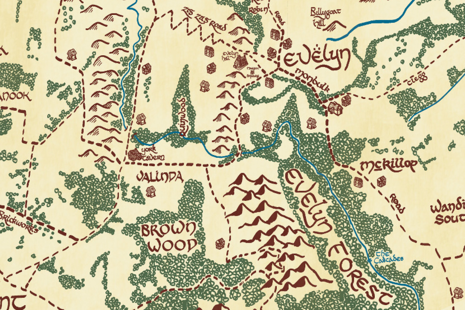
The Mt Evelyn Community House is proudly bringing you the launch of the much anticipated Mt Evelyn Tolkien style inspired map by local Cartographer Adam Mattinson Maps on Sunday 7th July at 11am.
Adam will be launching the Mt Evelyn map and sharing with us his influences on the local map as well as an insight into cartography.
Adam will have the Mt Evelyn Map for sale on the day as well as some of the other completed maps in this series. This will be a fun and informative event for all ages, with everyone welcomed. RSVP by the 3 July
From the Cartographer
My name is Adam Mattinson and I’m a cartographer. What’s a cartographer? A fancy name for making maps. Growing up in Mount Evelyn, with a passion for art, nature and the world around us, cartography was an obvious career choice, as it combines these elements on a daily basis.
My 9-5 is making maps for a consulting company, but on the side I create maps that are a bit out there. The Tolkien style map first started pen to pad about 2 years ago, given the nature and geography of the Shire, turning the area into a Lord of the Rings style world made sense to me. Now, the forests outside Healesville are home to elves, the quarries around Lilydale are mined by dwarves, and ents roam the mountains around Toolangi.
At full size the map is around 2 metres wide, and a bit over 1 metre tall, but while I finish the full Shire version which is probably 12 months away, I’m creating smaller “local” versions. The Mt Evelyn local map will encompass Lilydale and Coldstream to the north, and the forests and orchards of Kalorama and Silvan to the south.